


Early days of the establishment of Tran Giang (1739 - 1787)
In the process of exploiting the Southern land of our ancestors, Can Tho was reclaimed later than the upper region (Dong Nai - Saigon) and the lower region (Ha Tien). At the end of the XVII century, Mac Cuu - from Quang Loi, Guangdong (China) - who did not submit to the Qing Dynasty and many entourage and residents moved to Ha Tien by the sea in order to reside under the rule of Lord Nguyen. In August of the Rat year (1708), Lord Nguyen Phuc Chu ordained Mr. Mac Cuu as the Governor of Ha Tien town. Mac Cuu established a fort in Phuong Thanh, the people gathered more and more. In 1732, the entire southern land was divided by Lord Nguyen into 3 palaces and 1 town, those are Tran Bien Palace (Bien Hoa area), Phien Tran Palace (Gia Dinh area), Long Ho Palace (Vinh Long region) and Ha Tien town. In 1735, Governor Mac Cuu died, and his son Mac Thien Tich (formerly named Mac Thien Tu) was appointed Governor to succeed his father. From Ha Tien, he promoted the exploration of the land on the right bank of the Hau River. In 1739, he completed this exploration and established 4 new lands ("Gia Dinh Thanh Thong Chi" called "Dao"), including Long Xuyen (Ca Mau), Kien Giang (Rach Gia), Tran Giang (Can Tho), Tran Di (north of Bac Lieu) to merge into Ha Tien land.

The ancients reclaimed the land
Realizing that Tran Giang had a strategic position to serve as a solid backline for Ha Tien to fight against the Siamese and Chan Lap armies who frequently invaded and harassed, Governor Mac Thien Tich built Tran Giang land in all the fields including military, economic, commercial and cultural. The great minister Nguyen Cu Trinh was sent to the South by Martial King - Lord Nguyen Phuc Khoat in 1753 after meeting Governor Mac Thien Tich who also agreed with his strategy. Since then, Tran Giang has grown and become a strong "headquarter" in Hau Giang region. Not only is it a fortress in an important waterway location, but the headquarter Tran Giang - located on the west bank of the Can Tho river - is also a gathering place for people from all over the place to exploit and establish careers.
Due to its critical position, from 1771 to 1787, Tran Giang developed in a tumultuous historical context.
After capturing the capital Phu Xuan (1774), in March of the Rooster year (in 1777), the Tay Son army invaded Gia Dinh. In April of the same year, the chariot of Lord Nguyen ran down to Tran Giang. By August of 1777, the Tay Son army pulled down to the West and Tran Giang. In January of 1785, Nguyen Hue commanded the Tay Son army himself to defeat 20 thousand troops and 300 warships of the Siamese army, making the Rach Gam - Xoai Mut victory (Tien Giang) resounding. In 1787, the Tay Son army withdrew from the towns in the West, so the Nguyen Anh army regained these areas, including Tran Giang.
Tran Giang from 1788 until the French colonialists invaded
In the Pig year (in 1803), Gia Long Emperor delimited the remnants of the western region in the Hau River, changed its name from Long Ho to Hoang Tran Palace, and later changed it to Vinh Tran. By the Dragon year (in 1808), this land was called Vinh Thanh town, in which Tran Giang was located within the boundary of Vinh Thanh town. By the Rooster year (1813), Gia Long Emperor redistributed the land on the right bank of the Hau River, including the Tran Giang - old Can Tho, in order to establish Vinh Dinh district (under Dinh Vien government, Vinh Thanh town).
In the Dragon year (in 1832), Minh Mang Emperor issued a decree to change "town" into "province" and formed Six Provinces of Southern Vietnam. Minh Mang Emperor separated Vinh Dinh district (old Can Tho) from Dinh Vien palace (Vinh Long province) and placed it under Tan Thanh government (An Giang province).
In the Pig year (1839), Minh Mang Emperor changed the name of Vinh Dinh district to Phong Phu district, under Tinh Bien government (An Giang province), and took Tan An village as a place to rule Phong Phu district. Since then, Phong Phu district continued to develop and became famous as a prosperous land different from all other regions in the West at that time.
Tan An and Thoi Binh villages were formed early on this land. Therein, Binh Thuy village, due to the peaceful and calm river, people came to settle early, quickly developed, and became the original land of the people of Can Tho. Later, under the hands of human construction, the landscape became more poetic and literary, so posterity named the land of Binh Thuy - Long Tuyen.
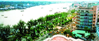
In Tran Giang, the riverway is the arterial traffic route, boats became so important to the point of necessity. Villages were formed on mounds stretching along rivers and canals. Markets were formed on river wharves and canals. The favorable river sections, bordering water, estuaries, junctions, and intersections become trading points, towns, and commercial and cultural centers of a region. Therefore, markets and towns located deep in the mainland, far from the river appeared only after roads were developed and vehicles became popular means of transport.
This feature may have formed since the end of the XVIII century in Binh Thuy - Can Tho region and is associated with other places stretching across the middle and lower Hau river. At the beginning of the XIX century, in the "Gia Dinh thong chi" mentioned trading centers such as the center of the west bank of Tran Giang (on Can Tho river); the center in Tra On River (under Binh Chanh canton) and the center of Truong tau Ba Thac (downstream of the Hau River) are similar with the trading centers on the right bank of the Tien River, namely Sa Dec and Long Ho. This is the most prominent feature that researchers have identified as "river and canal civilization" and to a higher extent are the floating markets at waterway intersections such as Tra On, Phong Dien, and Cai Rang later.
It can be said that this is the period when Tran Giang - Can Tho entered the stage of peace-building and increasingly consolidated the administrative and ruling system. Accordingly, Confucian ideology along with cultural-educational regulations, ethical and behavior standards are developed more and more.
The residential community in Tran Giang, including soldiers and soldier's families of Ha Tien, Rach Gia, and a part are exiled from other regions, from the East. Therefore, traces of traditional culture from other regions are still preserved in the worshiping traditions of many localities in the region.
Can Tho in the period of independence, construction, and development
The end of the XIX century, and the beginning of the XX century was a historical period with many violent changes in Six Provinces of Southern Vietnam. The French colonialists occupied 3 eastern provinces according to the concessions peace treaty of the Hue court in 1862. On June 20, 22, and 24, 1867, the French colonialists violated the 1862 peace treaty, occupying 3 western provinces: Vinh Long, An Giang, and Ha Tien.
On January 1, 1868, Governor of the Southern Vietnam, Bonard decided to merge Phong Phu district (Tran Giang - Can Tho) with Bai Sao (Soc Trang) and set it up as a district, establishing an administrative court in Sa Dec.
On April 30, 1872, Governor of the Southern Vietnam issued a Decree to merge Phong Phu with Bac Trang (an area under Lac Hoa government, Vinh Long province) to form a county, and to set up an administrative court in Tra On. A year later, Tra On's vicar moved to Cai Rang (Can Tho).
On February 23, 1876, the Marshall of Saigon issued a new Decree to take Phong Phu district and a part of An Xuyen and Tan Thanh districts to establish Can Tho county (“arrondissement de Cantho”) with the capital of Can Tho (Tan An village, the administrative district of the old Phong Phu district). In 1889, France changed administrative units at the county level to provinces and districts to prefectures.
From 1876 to 1954, the administrative boundary of Can Tho province during the French colonial period remained unchanged.
However, during the Anti-French Colonial Resistance War, the resistance government adjusted a part of the administrative boundaries of Can Tho province. Specifically, Can Tho received Thot Not district (Long Xuyen province) Long My, Go Quao, Giong Rieng districts, Rach Gia town (Rach Gia province) and Ke Sach district (Soc Trang province) and assigned 02 districts of Tra On and Cau Ke to Vinh Tra province (Vinh Long - Tra Vinh).
After the Geneva Agreements of 1954, the US imperialists turned the South of Vietnam into a new type of colony. Since then, the administrative boundaries of Can Tho province in the old regime in the South have changed a lot. In 1956, Ngo Dinh Diem's government decided to change the name of Can Tho province to Phong Dinh province. In 1961, separating a region in Long My, Vi Thanh established Chuong Thien province. After that, the districts, cantons, and communes in Phong Dinh and Chuong Thien provinces were all redistributed.
On the side of the revolutionary government, the name Can Tho was still maintained. The administrative boundaries have partial changed. In November 1954, Long My and the districts of Go Quao, Giong Rieng and Rach Gia town were brought back to Rach Gia province. Ke Sach district to Soc Trang province. Thot Not district to Long Xuyen province. Can Tho received back 02 districts of Tra On and Cau Ke as before. In 1956, Tra On and Cau Ke districts were brought to Vinh Long (in the US puppet period established a new province "Tam Can"). In 1957, Long My district moved back to Can Tho province. In 1958, Ke Sach district (in Soc Trang province) also moved to Can Tho province.
In 1963, Thot Not district (Long Xuyen province) returned to Can Tho province. In 1966, Vi Thanh town was established in Can Tho province. In 1969, Can Tho town was separated from Can Tho province in the Southwest region. In 1971, Can Tho town returned to Can Tho province. In 1972, Can Tho town became Can Tho city, directly under the Southwest region.
After the liberation of the South and reunification of the country, the Government issued Decree No. 03/ND-76 dated March 24, 1976, merging Can Tho province, Soc Trang province, and Can Tho city to establish a new province with the name Hau Giang, the provincial capital is Can Tho city.
In December 1991, the National Assembly of the Socialist Republic of Vietnam (term VIII) issued a resolution to separate Hau Giang province into Can Tho province and Soc Trang province.
On January 1, 2004, Can Tho province split into Hau Giang province and Can Tho city. Since then, Can Tho is a city directly under the Central Government.
Taking on the responsibility of the city directly under the Central Government, Can Tho is trying to promote its advantages in terms of geographical location, potential in economy, trade, science-technology, human resources, and tradition of solidarity, dynamic and creative spirit to rise to innovation, worthy of the status of a dynamic city, the "leading" development of the Mekong Delta region.
Source: Can Tho Portal - Translated by Hoang Dat